



ניווט AR למפעל: אתם מבזבזים זמן וכסף
באתר ייצור גדול, כל עובד לפחות פעם אחת בזבז זמן בחיפוש אחר בית המלאכה, המחסן או האזור הנכון. סימונים חדשים, מבנים דומים, גודל השטח — כל אלה הופכים משימה פשוטה למסע חיפושים.
הזמן שמתבזבז על התמצאות באתר הייצור מצטבר לשעות של השבתה, שמשולמות בתעריף כפול.
זה כואב במיוחד בזמן החלפת צוות, הגעת קבלנים או ביקורות. מבקר לא יודע היכן הוא נמצא ומסיח את דעת הצוות בשאלות. התוצאה: לוחות זמנים נדחים, ציוד עומד בטל, והמתח בצוות גובר. ניווט במפעל הופך להכרח, לא לנוחות, ומשפיע ישירות על ההכנסות.
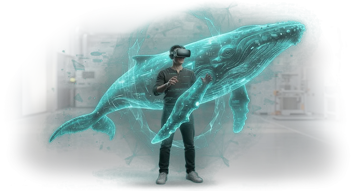
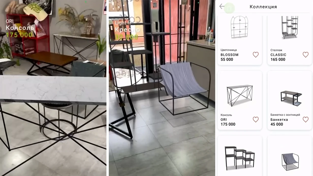
אנחנו פותרים את הכאב הזה עם אפליקציית AR. פשוט כוונו את מצלמת הסמארטפון או הטאבלט — וחץ מסלול מופיע על המסך, מונח על התמונה האמיתית של השטח. אדם מבין מיד לאן ללכת, גם אם הוא רואה את המפעל בפעם הראשונה. ניווט AR עובד ללא חיישנים יקרים וללא שינוי תהליכי הייצור.
הפתרון שלנו מתאים לאתרי ייצור גדולים, מרכזי לוגיסטיקה וקמפוסים עסקיים. הוא מקצר את זמן חיפוש האובייקט ב-30–40% ומקל על הצוות משאלות חוזרות של "איך מגיעים לשם".
הפיתוח אורך בין כמה שבועות לחודשיים, תלוי בשטח ובמספר נקודות הניווט.
אנחנו לא רק יוצרים אפליקציה — אנחנו מטמיעים אותה בתהליכי העבודה: אנחנו סוקרים את השטח, בונים מפה דיגיטלית ומשלבים ניווט עם מערכות האבטחה והחשבונאות הקיימות.
כתוצאה מכך, עובדים ומבקרים מפסיקים לבזבז זמן, ואתם מקבלים לוגיסטיקת כוח אדם ניתנת לניהול וצפויה בארגון.
מה ניווט AR נותן לכם: מהירות, דיוק וסדר
מבקרים במפעל הולכים לאיבוד בבתי המלאכה, עובדים מבזבזים זמן במציאת המתקן הנכון, וההנהלה מתמודדת עם שיבושים בלוח הזמנים. שלטים רגילים ותרשימי נייר לא עוזרים: באתרי ייצור גדולים, המסלולים משתנים, ואנשים עדיין שואלים לכיוונים. זה מאט את העבודה, יוצר מתח וגורם להסחות דעת מיותרות.
ניווט AR פותר את זה: על מסך הסמארטפון או הטאבלט, חצים ורמזים מופיעים ישירות מעל הזנת הווידאו החיה ומראים לאן ללכת. אין מפות נייר ואין שאלות לאבטחה — אדם רואה את המסלול לבית המלאכה, למחסן או לחדר הישיבות הרצוי בזמן אמת.
בצוות שלנו אנחנו מיישמים מערכות כאלה באתרי ייצור, והלקוח מקבל שלושה יתרונות עיקריים: מהירות, דיוק, סדר.
| פורמט | למי | מה זה נותן ללקוח |
|---|---|---|
| מצב אורח | מבקרים ומשלחות | חיפוש אובייקט מהיר, נוחות, רושם חיובי מהביקור |
| מצב עבודה | עובדים | מסלול מדויק ליעד, פחות איחורים ושאלות |
| מצב ניהול | הנהלה | סדר, בקרת תנועה, הפחתת השבתות |
לאורחים — נוחות וחיפוש אובייקט מהיר. מבקר לא מסתובב, לא מפספס פגישות, ונשאר לכם רושם חיובי מהביקור.
לעובדים — דיוק במסלול ופחות הסחות דעת: כולם יודעים איך להגיע למקום הנכון בלי להטריד עמיתים. להנהלה — סדר: ניווט מטיל משמעת, מפחית השבתות ומדגיש את היתרון הטכנולוגי של החברה.
המערכת רצה על חומרת AR מקצועית וארכיטקטורת שרת, כך שהמסלולים מתעדכנים מרכזית ותמיד תואמים את הפריסה הנוכחית. בסופו של דבר, אתם מקבלים כלי מודרני שמשתלם דרך חיסכון בזמן ושיפור השירות.
פורמטים של ניווט AR למפעל
במפעל, אותה משימה עולה כל יום: איך להגיע במהירות לבית המלאכה הנכון או למצוא מחסן. עובדים חדשים, קבלנים ומבקרים מבזבזים על זה שעות נוספות. ניווט AR מציב רמזים על התמונה האמיתית ועובד ללא שינוי מבנים. להלן ארבעה פורמטים שמתייחסים לצורך הזה.
| פורמט | למי | מה זה נותן |
|---|---|---|
| אפליקציית ניווט ניידת | עובדים, מבקרים, קבלנים | מסלול מנקודה לנקודה עם רמזים על המסך, ללא צורך בשלטים |
| סמני AR נייחים | זרימות המוניות, נקודות ביקורת | התמצאות מיידית: כוונו את המצלמה — ראו את הכיוון |
| תוכנית קומה אינטראקטיבית | מנהלים, אבטחה, אורחים | סקירה של כל האזורים והמסלולים, שליטה באזורים מסוכנים |
| שילוט אינטראקטיבי | סיורים, משלחות | שכבת מידע חיה לאורחים, תוכן משתנה לפי תרחיש |
בניגוד לתרשימי נייר, פורמטי AR לא דורשים הדפסה מחדש: כל שינוי נעשה תוך כמה דקות. האפליקציה מתאימה לניווט יומיומי של עובדים; סמנים נייחים מתאימים להתמצאות מהירה במקום לא מוכר. שילוט אינטראקטיבי משפר את חוויית האורח ומציג את המפעל כמודרני.
אנחנו עוזרים לכם לבחור פורמט או שילוב מותאם לגודל השטח ולתרחישי השימוש. התוצאה: פחות זמן מבוזבז, קליטת עובדים חדשים מהירה יותר, ומסלולים בטוחים.
איך עובד פיתוח הניווט
ניווט במפעל הוא לא מפת אימון אלא כלי עבודה שמשמשים אותו כל יום. לכן תהליך הפיתוח בנוי כך שתוכלו לראות תוצאות ביניים ולכוון את הכיוון לפני שהכל מסתיים.
- בריף פיתוח. אנחנו אוספים דרישות: אילו אזורים צריכים כיסוי, מי ישתמש — עובדים, קבלנים, מבקרים — ואילו תרחישים חשובים. אנחנו מבהירים תנאים: תנועת מסדרונות, שעות פעילות, סימנים מיוחדים והגבלות טריטוריאליות.
- אב טיפוס ניווט. אנחנו יוצרים מודל עבודה של הממשק: איך מחפשים אובייקט, איך בונים מסלול, מה נראה על המסך. זה מאפשר להעריך את ההיגיון לפני השקעה גדולה.
- אישור עיצוב. אנחנו דנים בעיצוב החזותי של המערכת: סגנון, צבעים, גופנים, שמות חדרים ומיקום נקודות מפתח. אנחנו מאשרים עיצובים — אחרי זה, הפיתוח ממשיך ללא עבודה חוזרת.
- התאמה לאתר ספציפי. אנחנו מתאימים את המערכת לתנאים שלכם: מעלים תוכניות, מגדירים חיפוש, מוסיפים אזורים מוגבלים. הניווט עובד על טאבלטים וסמארטפונים שכבר בשימוש בארגון.
- השקת ניווט. אנחנו מתקינים את המערכת, בודקים מסלולים על אובייקטים אמיתיים, מאמתים מרחקים ושלטים. אנחנו מתקנים אי-דיוקים במקום — ההשקה אורכת יום או יומיים.
- הדרכת צוות ותמיכה. אנחנו עורכים בריף קצר לעובדים: איך להשתמש במערכת ומה לעשות במקרי חירום. אנחנו מוסרים מדריך ונשארים בקשר אחרי ההשקה.
כל התהליך אורך שבועיים עד ארבעה שבועות, תלוי בגודל המפעל. אתם מקבלים ניווט שאנשים באמת משתמשים בו, לא רק אפליקציה מותקנת.
מה כלול במסירת הפרויקט
המסירה כוללת לא רק אפליקציה, אלא פתרון ניווט מלא ומוכן לשטח המפעל.
אתם מקבלים מערכת עובדת, תיעוד, צוות מיומן ותמיכה שוטפת — כל מה שצריך כדי להשיק את הפרויקט ללא כיבוי שריפות וללא תלות בקבלנים חיצוניים.
מה בדיוק כלול:
- אפליקציית ניווט עם מפת המפעל ובניית מסלולים לבתי מלאכה, מחסנים, חדרי ישיבות ונקודות אחרות. עובדים מפסיקים לבזבז זמן על שאלות, ואורחים מגיעים בזמן.
- הוראות משתמש — חומרים קצרים וברורים לצוות ולמבקרים. פורמטים שונים: מדריכים, סקירות וידאו, שאלות נפוצות. אף אחד לא צריך הכשרה ארוכה.
- הדרכת מנהלים — העובדים שלכם לומדים להגדיר את המערכת ולטפל במשימות יומיומיות בעצמם: מהוספת אובייקט חדש ועד שינוי פריסות תנועה.
- מערכת ניהול תוכן — ניתן לבצע שינויים ללא מעורבות מפתחים. ערכו שם, הזיזו נקודה על המפה, הוסיפו משרד זמני — האפליקציה מתעדכנת מיד.
- עדכונים שוטפים — אנחנו עוקבים אחר יציבות, מוסיפים תכונות שימושיות ושומרים על תאימות למכשירים חדשים של העובדים.
תוצאה: אתם מקבלים סט תוצרים שקוף ולא קופסה שחורה. כל שלב מובן להנהלה, והתפעול לא דורש מחלקת IT נפרדת.
מקרה בוחן: ניווט חסך 200 שעות עבודה
עובדים חדשים וקבלנים באתר ייצור גדול מבזבזים עד חצי שעה ביום במציאת בית המלאכה, האזור או המחסן הנכון. כל התמצאות היא זמן השבתת ציוד, צוות ממתין ושעות עבודה אבודות.
עבור מפעל עם מבנים מרובים, הבעיה גדלה למאות שעות עבודה אבודות בכל חודש.
עבור מפעל ההנדסה "סטאלפרום", פרסנו ניווט AR: עובד מכוון מצלמת סמארטפון לבית מלאכה או אזור טכנולוגי — ורואה את החץ, המרחק ושם האובייקט ישירות מעל התמונה.
המערכת רצה על מכשירים ניידים רגילים, ללא סמנים מיוחדים או ציוד יקר, כך שההטמעה ארכה שלושה שבועות.
תוצאות הפרויקט:
- קיצור זמן מציאת נקודה נדרשת במפעל מ-15–20 דקות ל-2–3 דקות. בממוצע, ההתמצאות הפכה למהירה פי 5.
- חיסכון של 200 שעות עבודה בחודש — השעות האלה הופנו להכנת עמדות עבודה והשקת קווים חדשים, לא להליכה בשטח.
- ביטול התלות ב"וותיקים" שנהגו ללוות חדשים בבתי המלאכה. עכשיו עובדים חדשים עובדים עצמאית מהיום הראשון.
הניווט משמש למחסנים, מכונות, מעבדות ומבני מנהלה — מסלול נבנה ישירות לאובייקט, תוך התחשבות במעברים פנימיים ואזורים מוגבלים.
מנהל הייצור ציין: "ציפינו שזה יהיה נוח, אבל לא חשבנו שההשפעה תהיה כל כך מדידה.
אחרי חודש חישבנו מחדש את העומס — הפסדים מתנועה כמעט נעלמו, וקבלנים וחדשים הפסיקו לשאול לכיוונים." אחרי השלב הראשון, המפעל הזמין הרחבת ניווט לכל המבנים ושילוב עם מערכת ההזמנות הפנימית שלו, כך שעובדים רואים לא רק את המסלול אלא גם משימות עדכניות באזור שלהם.
מה אם האפליקציה תתקלקל או תתיישן?
אתם מודאגים שניווט AR יהפוך לעוד מערכת שדורשת תשומת לב מתמדת. זו שאלה הוגנת: כל אפליקציה המשולבת בתהליכי ייצור חייבת לעבוד בצורה אמינה ולהתפתח יחד עם המפעל.
אנחנו בונים פרויקטים כך שלעולם לא תתמודדו עם בעיות לבד. אחרי ההשקה, אתם מקבלים תמיכה טכנית, עדכוני מסלולים שוטפים וגיבויי נתונים. אם משהו משתבש, האפליקציה לא תעצור את הפעילות, והמעבר לתוכנית חירום ייקח דקות.
חשוב גם שאנחנו לא נעלמים אחרי מסירת הפרויקט. צוות שמכיר את המתקן שלכם נשאר איתכם. כל השינויים — בתי מלאכה חדשים, העברות ציוד, שינויי לוגיסטיקה — מבוצעים במהירות ובלי לעצור את הפעילות.
להלן תשובות לשאלות הנפוצות ביותר לפני התחלה.
כמה מהר אתם מגיבים לתקלות?
למצבים קריטיים, יש לנו מדיניות — תגובה בתוך יום עבודה. אנחנו פותרים את רוב הבעיות מרחוק, ללא ביקור באתר. אתם תמיד יודעים מי אחראי על המערכת שלכם.
מה אם המסלולים במפעל משתנים?
מסלולים הם נתונים, לא קוד. אנחנו מגדירים עדכונים כך שתוכלו לשנות נקודות ניווט ללא מתכנת. אם צריך יותר, אנחנו מבצעים שינויים לפי בקשה תוך כמה ימים.
האם אתם מספקים גיבוי?
כן, גיבויים נוצרים אוטומטית. אם מתרחשת תקלת שרת, האפליקציה תעבור ללולאת גיבוי, והייצור לא ייעצר.
מה אם החברה שלכם תפסיק לפעול?
אנחנו מעבירים זכויות מלאות לקוד המקור ולתיעוד, ומשאירים את המערכת הפרוסה בתשתית שלכם. אתם לא תלויים בנו לחלוטין — זה מסיר את הסיכון העיקרי.
איך לבחור פורמט ניווט לתהליך הייצור שלכם?
בחירת פורמט ניווט מתחילה לא בטכנולוגיה אלא במאפיינים הספציפיים של הייצור שלכם. חשוב להבין מי ישתמש במערכת — עובד במחסן, אורח בסיור או מהנדס במהלך בדיקת ציוד.
רמות רעש, תאורה, אזורים מסוכנים ודרישות דיוק מסלול — כל אלה נחשבים. פרמטרים אלה קובעים אם אתם צריכים ניווט מעוגן לאובייקט, אינדיקטורים המונחים על חלל אמיתי או מצב אוטונומי לחלוטין.
דרישות עסקיות אישיות הן קריטריון הבחירה המרכזי. מפעל אחד מיישם ניווט להתמצאות מהירה של עובדים חדשים; אחר משתמש בו כחלק ממערכת בקרת תהליכי ייצור.
במקרה הראשון, העדיפות היא פשטות הממשק ומהירות ההכשרה; במקרה השני, מעקב נקודות אמין ושילוב עם מערכות חשבונאות קיימות. לכן אנחנו תמיד מתחילים בביקורת תהליכים והגדרת יעדים, ורק אז בוחרים את הפורמט המתאים.
מאפייני הייצור מטילים אילוצים הנראים רק באתר. לדוגמה, בשטח פתוח עם מבני מתכת רבים, ניווט לוויין לא יספק את הדיוק הנדרש, בעוד שבבית מלאכה סגור עם לחות גבוהה ורעידות, יידרש ציוד מיוחד.
המומחים שלנו מבקרים באתר, לוקחים מדידות ובודקים פתרונות בתנאים אמיתיים כך שהמערכת תעבוד בצורה אמינה בסביבה שלכם.
עלות ההטמעה מחושבת לאחר הביקורת, כוללת לא רק פיתוח וציוד אלא גם תחזוקה, עדכוני תוכן והדרכת צוות.
אנחנו עוזרים לכם לבחור פורמט שמשתלם מהר יותר: לפעמים אפליקציה ניידת עם אינדיקטורי AR מספיקה, ובמקרים אחרים נדרשת מערכת נייחת עם תמיכה רציפה. בכל מקרה, אתם מקבלים היקף שקוף ולוחות זמנים ברורים ללא עלויות נסתרות.
העיקר הוא לא לבחור פורמט "בעיוורון". ניווט במפעל עובד רק כשהמשימות, התנאים והתקציב שלכם נלקחים בחשבון.
לכן הצעד הראשון שלנו הוא ניתוח חינמי של תהליך הייצור שלכם ושתיים או שלוש אפשרויות עם הערכת עלות ותועלת. כך, אתם מקבלים החלטה על סמך עובדות, לא ניחושים.
הזמינו פיתוח למשימה שלכם
כל פרויקט ניווט AR למפעל הוא ייחודי: פריסות, אזורי גישה, פורמטי מכשירים ומשימות עובדים שונים. לכן אנחנו לא מוכרים פתרונות קופסה מוכנים; אנחנו בוחרים ארכיטקטורה ומדיה מותאמים למתקן שלכם.
השאירו בקשה להערכה — ותוך יום עבודה אחד תקבלו הערכה ראשונית של תקציב ולוחות זמנים. אין לכם מה להפסיד: הייעוץ חינמי, והמפרט הטכני נשאר שלכם גם אם תחליטו לעבוד עם צוות אחר.
מה כולל התהליך:
- בקשה להערכה — אתם שולחים תוכנית בית מלאכה או תיאור משימה, אנחנו מבהירים פרטים.
- ייעוץ חינמי — אנחנו מנתחים תרחישים: למי הניווט, אילו מכשירים יש לעובדים, האם נדרשת שילוב עם מערכות ארגוניות.
- בחירת פתרון — אנחנו משווים אפשרויות: ניווט AR לטאבלטים, משקפיים או טלפונים ניידים; בוחרים את זה שנותן תוצאות מהירות ללא השקעה מיותרת.
- הצעה מסחרית במחיר קבוע — אתם יודעים את העלות לפני התחלה, ללא תוספות נסתרות.
- פיתוח מפתח — עיצוב, תכנות, הטמעת תוכן ובדיקות באתר שלכם.
- תמיכה לאחר ההשקה — אנחנו מאמנים עובדים, תומכים בשבועות הראשונים ומשפרים על סמך משוב.
אנחנו עובדים מרחוק כבר למעלה מ-10 שנים, כך שהגיאוגרפיה של הלקוחות אינה מוגבלת. הצוות שלנו מטפל בכל המחזור: מהפגישה הראשונה ועד להפעלה.
השאירו בקשה — נספר לכם איך ניווט AR יקצר את זמן חיפוש האובייקט במפעל שלכם, ונשלח הערכה תוך יום אחד.